2015-03-10 14:24
the astronauts in the eyes of the sublime earth: from red blood the dunes to the concrete jungle
|
CNDSN3 month 10 days (Sina) news in March 10th, 16 years, astronauts on the international space station has been from the space of this unique angle shooting pictures of the earth, majestic and magnificent human homes with their hands of the camera to record. The graph is the Lou Bo Harry desert dune structure different. Lou Bo Harry desert known as the "blank", is the second largest desert on earth, an area of 65 square kilometers.
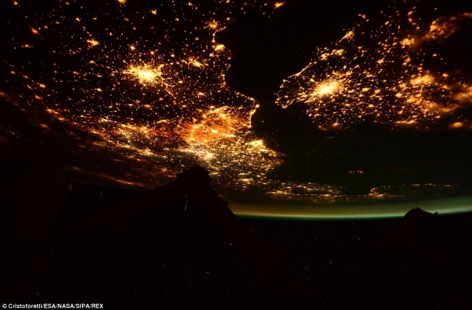
A picture of forty-second expedition member Christoforetti January shooting over the English channel, show along the south coast of England and France over the north shore of bright lights. This picture reveals a large urban intensive light, the curve of the earth and a green like the aurora borealis.
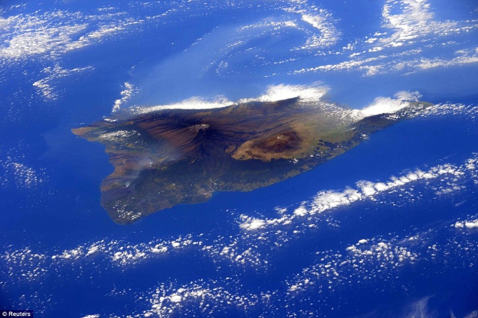
Filming on the big island of Hawaii over the photo, Mona Luo Yashan and Mauna Kea in central. Island area of 10432 square kilometers. Mauna Loa is one of the largest and most active volcano eruption of the world, can be formed when the terrible threat magma River, near the town of. This volcano volcano elevation of close to 9 km, the surface has nearly 90% of the area is history to 4000 magma covered
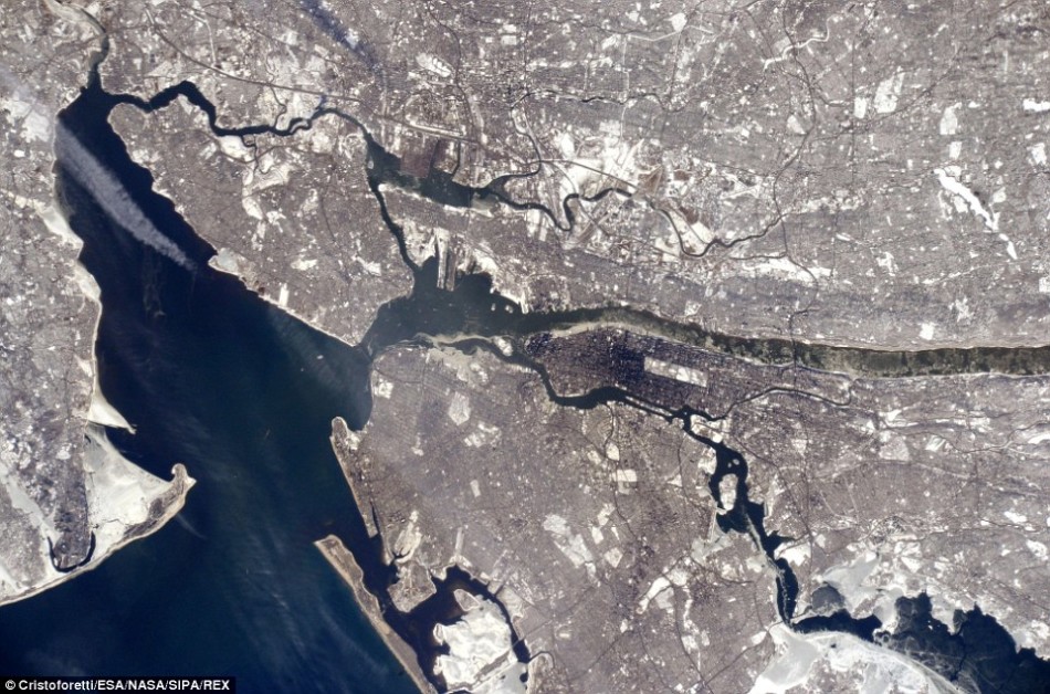
"Samantha Christoforetti in the eyes of the landform" photo collection also included to show the concrete jungle of New York intensive photos. In the photo, in stark contrast of color grey concrete color landform and the blue ocean. Manhattan is the center of the very dense population and buildings, almost black. In the photo, John - J.F.Kennedy.Apt Airport airport more open space legible
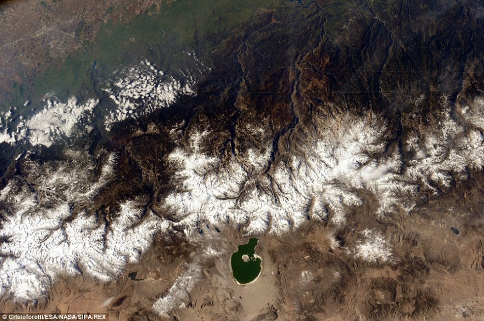
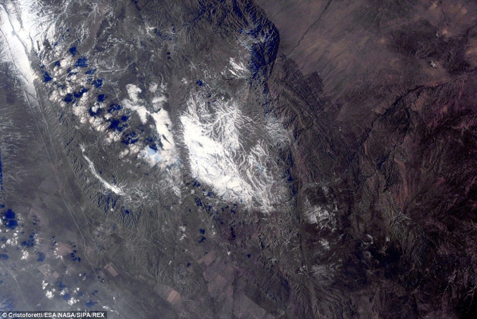
California's Yosemite National park. The park is a snow covered mountains, including Mount Danner, sariyer hill and Warren hill. The photo at the bottom of the lake is named "Lake Monod" paja island in Lake Monod central. Yosemite National Park area reached a staggering 1190 square miles (3081 sq km)
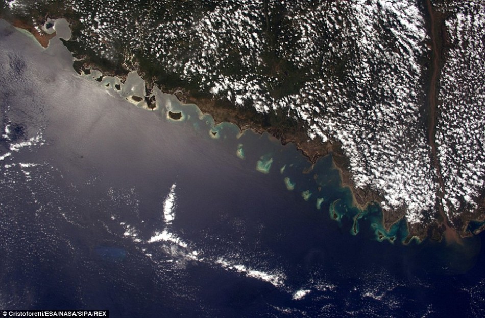
In the space station across Africa, the Middle East and Asia in the process, Christoforetti also captured Mozambique, Kazakhstan and Pakistan coast line of sight Taimuge. The rugged rocks in Mozambique coastline, especially near the Baia de Sofala area, its coastline stretches for 4313 miles (about 6942 km)
Canadian geography center David Mike Leen says this piece of picture of the Earth shows beautiful images of Bahamian archipelago, especially Long Island, acklins island and rugged island. At left is Cuba, Florida in the right
Kazakhstan is located in the Taimuge, Xie m Lieqi a rock painting archaeological sites, from about 120 kilometers northwest of Alma ata. Taimuge has nearly 5000 rock paintings, mostly in the main Canyon, history can be traced back to the bronze age. The name "Taimuge" means "take pictures or mark place" in the Kazakh language, in 2004 was listed by UNESCO as a world heritage site
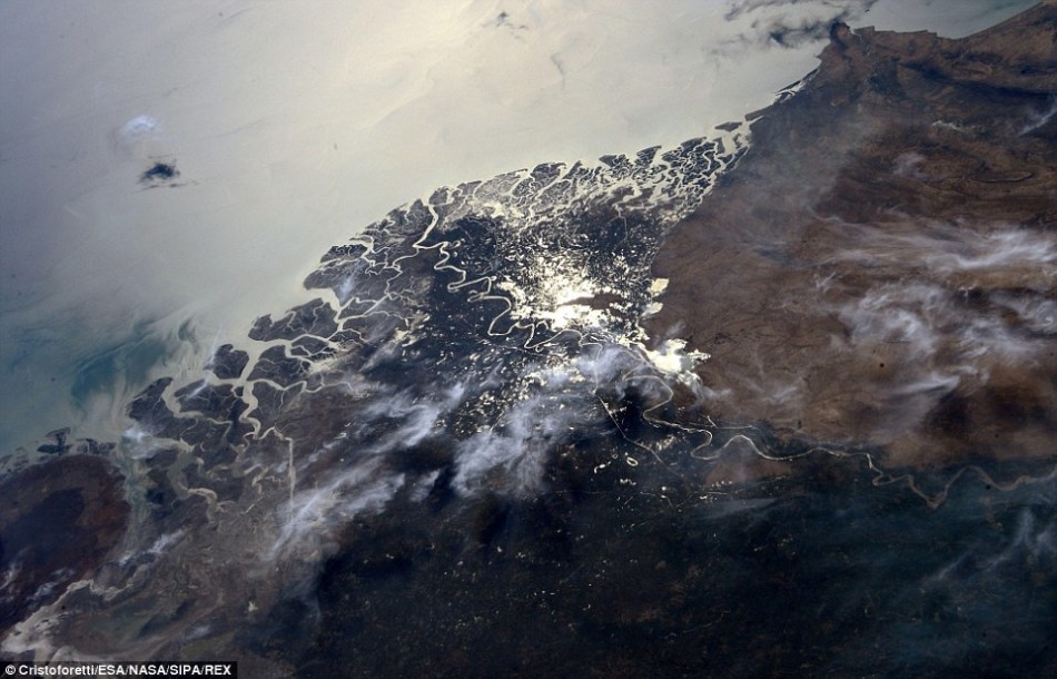
Over Pakistan, Christoforetti used the camera to record the beautiful scenery under the India River delta. India delta is an important area in the South Asian country, the India river flows into the Arabia sea in here. Both sides of this Delta South Cody Bond wildlife reserve and Malho - kotri wildlife reserve. India delta is an arid area. (original title: the astronauts in the eyes of the sublime earth: from red blood the dunes to the concrete jungle) Editor: Blue
|